Downtown Homelessness
A project to digitize homlessness counts from the Downtown San Diego Partnership
View the Project on GitHub sandiegodata-projects/downtown-partnership
Counting Downtown San Diego Homeless
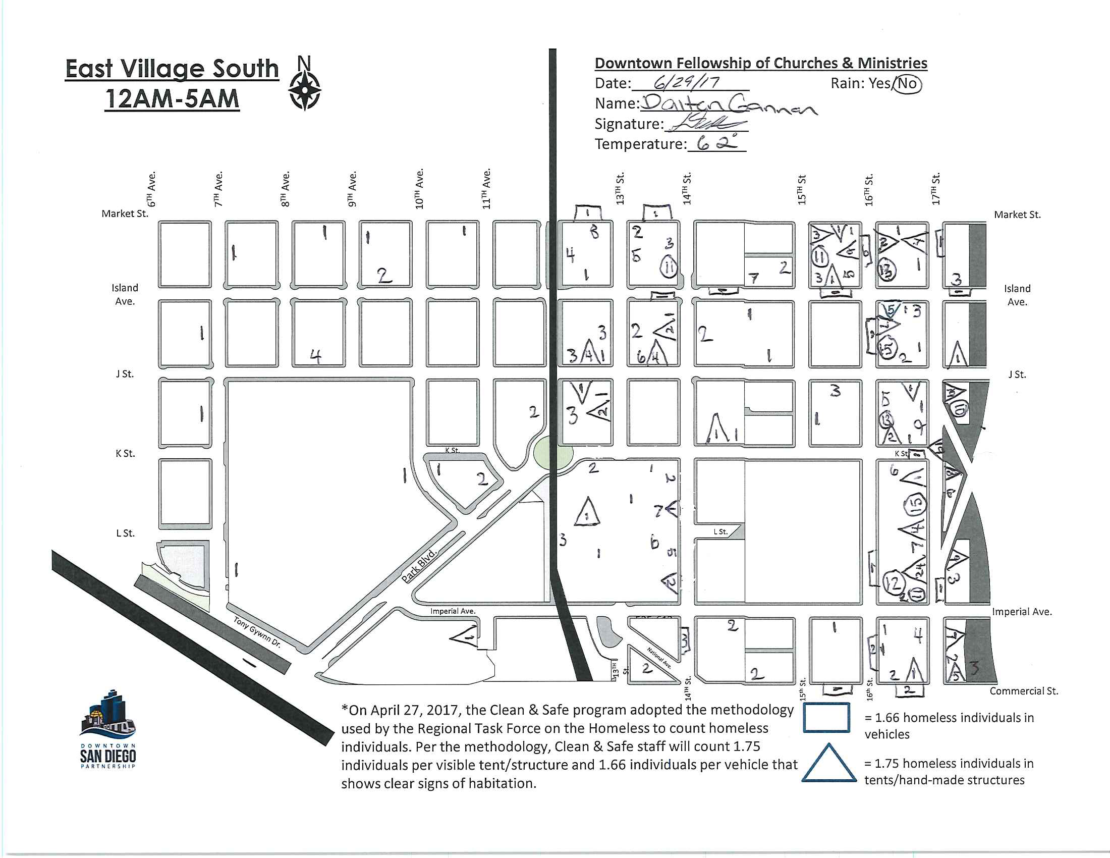
For the last 7 years, the Downtown San Diego Partnership has been conducting monthly counts of homeless in the Downtown neighborhood. The data is recorded on paper maps, which are compiled into a spreadsheet. This is a fantastic dataset which would be even more useful if the hand-recorded paper maps were digitized.
This project involves collecting and digitizing 5 years of the monthly maps, to produce a geographic dataset, whcih we will analyze for time trends and for the association between homless movements, geography and the built environment.
The data has been collected and organized, and now we need volunteers to georeference the maps and digitize them to produce gepgraphic datasets that we can combine into a single dataset.
Here is one of the maps that we will digitize:
This project will involve:
- Extracting images for each of the neighborhood maps for each month.
- Geo-referencing
- Digitizing each of the count locations
- Combining all of the digitized datasets into a single combined dataset.
- Analyzing the combined data.
When the project is complete, we will have a monthly, geographically precise accounting for the 500 to 1000 homeless people in the Downtown neighborhood, about 20% of all unsheltered homeless in the county.
All of the maps for this project are online in Google Drive. Last year, A student group at the Kearney High School of Science, Connections and Technology are spending the end of the year digitizing and analyzing a few of the neighborhoods. See the maps and dataset results from this awesome student project.
Help with the Project
Getting involved in this project is really easy! Visit our list of tasks and select one of the tasks. Everything you need, including detailed instructions, is linked from the Github issues.
There are two major kinds of tasks:
- Geo-refrerencing maps, to identify four road intersections on each map by placing ground control points. See the detailed instructions for ground control point tasks.
- Digitizing handwritten homeless count marks, putting circles around numbers in the maps that indicates where homeless people were found. See the detailed instructions for count digitization tasks.
As we get data back for these two kinds of tasks, we’ll use a program that analyzes the GCP results to produce a transformation function that can convert the pixel locations of the handwritten homeless count numbers into geographic positions ( latitude / longitude ). Then we’ll collect all of the data into a dataset for analysis.
Special Thanks
Special thanks to volunteer digitizers:
- Kelly Abbott
- Jorge Bonilla
- Marketne Noel
Joining the Project
- Email eric@sandiegodata.org that you’d like to join
- Attend one of the Meetups.